Most people who live in the You Yangs Ward can see these hills from their kitchen window, and a surprising number have never walked them. That's a shame, because within about twenty minutes of Lara you can be standing on granite that's roughly 400 million years old, looking at Port Phillip Bay on one side and the Brisbane Ranges on the other.
The You Yangs is a regional park, not a national park — which matters more than it sounds. It means dogs on lead are welcome, mountain bikes have their own trail network, and the rules are generally more relaxed than places like the Grampians. It also means the tracks range wildly in difficulty, and the park's own signage doesn't always make that obvious before you're halfway up.
The park sits on Wadawurrung Country. The traditional name, Wurdi Youang, is widely translated as "big mountain in the middle of a plain" — which is exactly what it is. There's a stone arrangement on the western side of the range recognised as one of the most significant Aboriginal astronomical sites in Australia. It's not publicly accessible, and that's appropriate.
Figure 1 — The park at a glance
What you're working with.
Figures are indicative. Elevation for Flinders Peak is variously published between about 320 m and 365 m depending on the survey datum used; treat roughly 350 m as the working number. Always check Parks Victoria for current closures before you leave.
01 / Pick your trackFilter by what you've actually got time for.
This is the part most guides get wrong. They list tracks by name and leave you to guess. Below, you can filter by grade, by how long you've got, and by whether you need a pram-friendly or wheelchair-accessible surface. Times assume an average walker stopping for photos — not a trail runner.
Figure 2 — Interactive track picker
Eight tracks, filtered your way.
Flinders Peak Summit Walk
1 – 1½ hoursThe one everyone means when they say "we walked the You Yangs". A relentless staircase from the Turntable car park to the highest point in the range. There's no gentle warm-up — it goes up almost immediately and keeps going.
Don't be fooled by the distance. Three kilometres sounds trivial; 450 steps at a steady gradient is not. Allow more time than you think on the way down, too — tired legs on granite steps is how ankles get rolled.
Big Rock Lookout
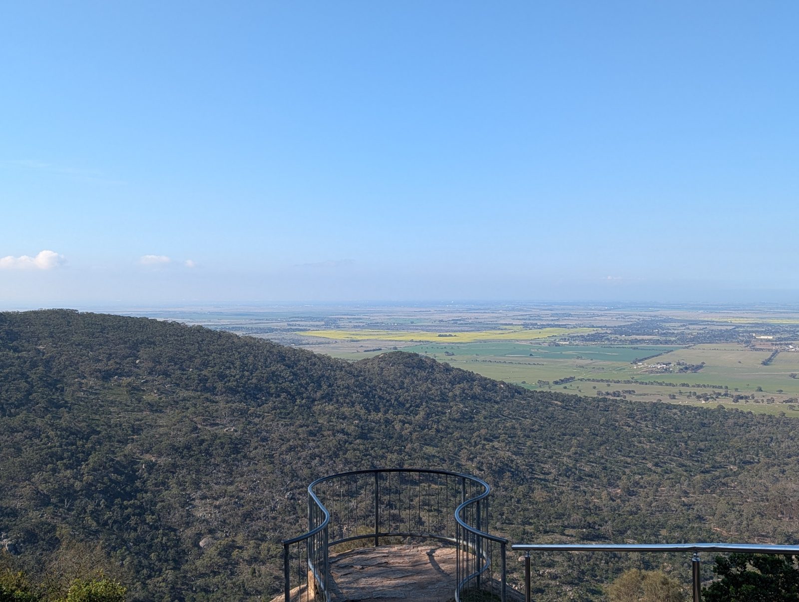
15 – 25 minutesThe best view-to-effort ratio in the park by a wide margin. A short walk out onto an enormous exposed granite dome on the western side of the range. Big Rock is where you take visitors who say they don't feel like a hike.
Watch your footing on the granite — it's grippy when dry and genuinely slippery when wet, and the dome slopes away without any railing. Keep small children close and stay well back from the edges.
Bunjil Geoglyph Walk
25 – 40 minutesA short, flat walk to a large-scale earth artwork depicting Bunjil, the wedge-tailed eagle creator figure central to Wadawurrung and wider Kulin culture. The work was created with stone and earth on the ground plane, so it reads best from the viewing area rather than up close.
Best combined with something else. On its own it's a short outing; paired with the Great Circle Drive and a picnic it makes a comfortable half-day for people who don't want to climb anything.
Branding Yard Loop
1 – 1½ hoursThe quiet one. A loop through open woodland and grassy clearings on the park's northern side, with far fewer people than the summit or Big Rock. Undulating rather than steep.
This is the wildlife walk. Early morning or late afternoon you'll almost certainly see kangaroos, and it's the best of the tracks for birds — parrots, honeyeaters, and if you're lucky a wedge-tailed eagle working the thermals overhead.
East–West Walk
45 minutes – 1¼ hoursCrosses the range rather than climbing it, linking the eastern and western sides through a saddle. Because it isn't a loop you'll need two cars, or a walking partner willing to double back.
Underrated. You get a genuine sense of the range's structure — how narrow it actually is, and how abruptly the plains start on either side.
Turntable Nature Loop
10 – 20 minutesA short interpretive loop right by the main car park, with signage on the park's granite geology and vegetation. Genuinely useful as a warm-up before the summit climb, and a sensible option if someone in your group isn't up for the steps.
The practical choice when half your group wants Flinders Peak and half doesn't. One lot climbs, the other loops and waits with the thermos.
Rockwell Track
1½ – 2½ hoursA longer walk on the park's southern flank following management tracks and single trail. Wider and less stepped than the summit walk, so easier on the knees, but noticeably longer.
Be bike-aware. Sections of the southern park are popular with mountain bikers who come through faster than you'd expect. Keep left, keep dogs close, and don't wear both earbuds.
Full-day link-up (Flinders Peak + Big Rock + Branding Yard)
3½ – 5 hoursNot an official Parks Victoria route — it's a day you build yourself by stringing the tracks together with short drives or road walking on the Great Circle Drive. If you want a genuine day out in the You Yangs rather than a quick summit, this is it.
Start early and carry everything. There's no water and no food anywhere in the park. Do the summit first while it's cool, Big Rock in the middle, and finish on the Branding Yard loop when the roos come out.
No tracks match that combination. Try loosening one of the filters.
Distances, climbs and times are indicative working figures for planning, gathered from park signage and repeated walking — not survey data. Grades follow the Australian Walking Track Grading System loosely. Check Parks Victoria for official measurements, closures and current track conditions.
02 / Where things areThe shape of the park.
The You Yangs is essentially one narrow granite range running roughly north–south, wrapped by a one-way scenic road called the Great Circle Drive. Almost everything you'd want to do hangs off that loop. Here's how it fits together.
Figure 3 — Orientation diagram
How the park is laid out.
Schematic only — not to scale and not for navigation. Positions are indicative to help you understand how the park hangs together before you arrive. Use the official Parks Victoria park note or a mapping app on the ground.
03 / When to goBusy times, honestly.
The You Yangs has become genuinely popular, and on a fine Saturday the Turntable car park can be full by mid-morning. That's a good problem — it means people are using the park — but it's worth planning around. Here's roughly how the week runs, based on repeated visits.
Figure 4 — Busy times heatmap
When the car parks fill.
Hover or tap a cell for detail. Pattern is observational, not measured — school holidays, long weekends and fine weather after a wet spell all push everything up a level. Big Rock runs against the trend at dusk: it's the sunset spot, so late Saturday is busier there than the summit.
Weekday before 9 am is the whole game. You'll have the summit almost to yourself, the light is better for photos, and in summer you'll avoid the heat entirely.
If a weekend is your only option, arrive before 9 am or after 2:30 pm. Between about 10 am and 2 pm on a fine Saturday, expect to queue for a park at the Turntable and to be sharing the summit platform.
04 / What to packTick it off before you leave.
The single most common mistake at the You Yangs is treating it as a stroll. It's close to town, it's well signposted, and it's genuinely popular — all of which makes people underestimate it. There is no drinking water in the park, no food, and mobile coverage drops out in the gullies.
Tick these off as you pack. Your progress saves in this browser, so you can come back to it next time.
Figure 5 — Interactive packing list
The You Yangs kit.
Non-negotiable
Strongly recommended
Your ticks are stored in this browser only — nothing is sent anywhere and nothing is tracked.
05 / SafetyThe four things that actually cause trouble.
Figure 6 — Local hazards
What to watch for.
Heat and fire danger
The park closes on Code Red days, and hot northerlies make the exposed range brutal. Check the Fire Danger Rating and the Parks Victoria closures page the morning you go, not the night before.
Snakes, spring to autumn
Eastern brown and tiger snakes live here. Stay on the tracks, don't step over rocks and logs you can't see behind, keep dogs on a short lead, and carry a compression bandage in warm months.
Wet granite
The rock that makes this place worth visiting is properly slippery after rain or in morning dew — especially the open slabs at Big Rock. If it's damp, treat every granite surface as ice and stay well back from edges.
Shared trails
The southern park is popular with mountain bikers moving quickly. Keep left, don't wear both earbuds, keep dogs short-leashed, and step aside on blind corners rather than assuming you'll be seen.
In an emergency call 000. If you can't describe where you are, the track name and nearest car park are the most useful details you can give — which is a good reason to note them when you set off.
06 / The bigger pictureWhy access to these hills matters locally.
I've written elsewhere about the proposed Lara to You Yangs Shared Trail — a continuous connection running from the existing Hovells Creek Trail through to Serendip Sanctuary and on to the You Yangs Regional Park. Right now, getting from Lara township to these tracks essentially requires a car.
That's a gap worth closing. A safe, continuous walking and cycling connection would mean a family in Lara could reach one of Victoria's most recognisable landscapes without driving, and it would link two significant natural attractions in a way that creates real recreation and tourism value for the north.
It's the kind of infrastructure that sounds like a nice-to-have until you notice how many people can't currently get there — and then it looks like basic access.
Before you go: check the official You Yangs Regional Park page at Parks Victoria for current closures, track conditions, the park note and map, and the day's fire danger rating. Conditions in this park change with the weather far more than people expect.